 |
Bungala Ridge Permaculture Gardens REDUCE ... REUSE ... RECYCLE ... REPAIR ... RETURN ... REVEGETATE ... REPLENISH |
||||||||
|
|||||||||
|
|
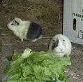
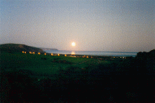
Site Details Bungala Ridge Permaculture Gardens occupies four and a half acres on a south facing slope overlooking the Bungala River and Yankalilla township. It it situated about three kilometres from the protected waters of the Gulf of St Vincent with views to Kangaroo Island. Existing vegetation on the property consisted of wild olive, golden wattle, pink gum and various pasture grasses with some native ground cover and climbing species. The following details are from the design Robin submitted as part of his Permaculture Design Certificate course requirements which he completed in 1997. Our property was purchased in 1988. We had already built the house and established the main elements of the overall property design. The design certificate required a design for a 500 square metre property - Robin's design was for just over one acre, the land immediately surounding the house, although the whole property is being developed using permaculture principles. Permaculture Design Needs Analysis Aspirations, Values and Lifestyle Size & Locality Details Size of Property: 4.5 acres Size of Permaculture Design Plan: 3200m² (around house) Municipality: Yankalilla District Council Council Zoning Requirements: Rural Living Land Use in Local District: Dairy, sheep, hay production, some wine grapes, holiday homes, hobby farms, revegetation of native species. History of Use: Grazing and dairy mostly, early wheat cropping (1800's); nearby spring would have been used by Aboriginal people and early European settlers. Services Available: Power available near-by but not connected to property, town water supply, local area school (children home educated though), daily bus to suburbs and Kangaroo Island, walking distance to shops and school (15-25 minutes), phone connected. Ease of Access/Roads: All weather gravel roads; at end of no through road. Site Resources Available: Wild grasses (which can be used as mulch, fodder for poultry and guinea pigs), coprosma and acacia hedge, Allocasuarina windbreak, 3 walnut trees (est. 8 years), various deciduous trees (fire break in north west sector), house, tropical plant shadehouse, tool and battery shed, composting toilet, compost and quarantine area, three two thousand gallon rainwater tanks, header tank and tower, driveway (rough and not all weather!), solar panels, wind power and petrol generators, nursery shadehouse, chicken house and enclosed yard, duck shelter, pond and enclosure, guinea pig enclosure and free ranging shelters, 5 small bog ponds (cultivation of edible and useful plant and animal species), greywater filtration system. The following resources are on the same property but not on the site plan: citrus and fruit orchard (established 8 years), cabin, established and existing eucalyptus, large trees and woodlot for firewood collection, storage shed, olives, native animals (fertiliser and grass grazing). Tools and Equipment Available: Various building and gardening tools, energy generation systems, human labour. Water Catchment (sources, size, reliability, drainage, flood potential, etc.): East end of property prone to waterlogging on slope producing run off which flows down driveway and spills over down hill about half way across property. Run-off comes mainly from adjoining cleared property to north, and occurs mostly form heavy downpours. Cloudbursts of up to 1 hour duration can cause back up of water against structures and water sheeting down hill. Erosion down driveway. Possible sites for small dams where water seeps from hill in low gully on sandy loam soil. Main catchment from rain in tanks from cabin and house at present. Topography (altitude, slope/contour, aspect, valleys/ridges, shelter/exposed areas, etc.): Average slope of property 1:5. Lowest contour 70 metres, highest 88 metres. South facing aspect, exposed to weather from east, south and west; sheltered from north weather (just) by low ridge to north. Soil (type, depth/profile, biological stability, drainage, pH, reports/maps, etc.): Limestone rock underneath clay approx. 750mm depth average over property. Topsoil varies from eastern end (heavy clay loam, 300mm deep) to western end (up to 900mm deep sandy loam over clay). Good soil life in winter - lots of worm activity, and creatures living in humus and moss cover on surface. Lots of different ants. Termites (hardwood eating). Soil relatively stable, no sign of slips prevalent in cleared and steeper local sites, however subsoil clay is reactive. Existing Vegetation (type, dominant species, native/exotic species, area, disturbance/health, density, weeds, etc.): Mostly planted species up to 8 years of age: deciduous exotics, native shelter belts, fire retardant shelter belt, vegetable and flower species, agapanthus border, bean mulch crop, water plants, nut trees (almond, walnut and chestnut), passionfruit and grape vines, berry fruit species, shadehouse plants. Plant density varies with location and use. Non-notifiable weeds including some couch and kikuyu (most weeds hand harvested on site for guinea pig food), oxalis (sour sob) in winter. All vegetation is healthy with minimal disease present or observable. The following vegetation is on the same property but not on the site plan: dominant native species is eucalyptus fasciculosa, young grass trees, kangaroo and wallaby grass, native cranberries, native creepers and lilies. Dominant exotic are olives (some already removed by occupants from around house area). Planted species include native indigenous tree and shrub species, native non-indigenous tree, shrub and ground cover species, nut, stone fruit, citrus, apple, pear, persimmon, fruiting vine species. Weeds consist of exotic grasses, cape tulip, sodom apple, oxalis, salvation jane (minimum invasion) and some broad leaf weeds. Existing vegetation appears healthy. Existing Fauna (native mammals/birds, introduced/feral animals, reptiles, etc.): Kangaroos, echidnas, snakes, lizards, frogs, bats, possums, magpies, crows, shrikes, yellow tale black cockatoos, galahs, kookaburras, kites, small birds (wrens, silvereyes, finches, honeyeaters). Introduced animals include goldfish in ponds, guinea pigs, bantams, pigeons, muscovy ducks. Roaming dogs, cats and foxes are a problem. Notable Feature (views, old growth forests, rock outcrops, swamps, etc.): 180' panoramic views to south across Bungala valley and Gulf St Vincent. Neighbouring Properties (use, vegetation, cooperation): Revegetation of properties with native species, hydroponic commercial tomato growing in greenhouse, recreation (kite flying) and weekender, sheep agistment. Problems (noise, pollution, chemical residues, etc.): Visible high voltage power lines to south on next property (can be screened with tall trees). Noise from main road when southerly winds blow. Maps and Plans Available (aerial photos, topographic maps, deed titles, whole farm plans, etc.): Photocopy of aerial photo (about ten years old), house plans and copy of title.
|
Hot Links!
This site is sponsored by EditRegion2 |
|||||||
|
|
|
|
|||||||